Best Texas State Parks for Aerial Nature Shots
Texas offers spectacular aerial photography opportunities across diverse landscapes. You'll find dramatic compositions at Enchanted Rock's pink granite dome, Big Bend Ranch's rugged canyons, and Monahans Sandhills' sculptural dunes. Garner State Park showcases the winding Frio River amid lush forests, while Brazos Bend delivers wildlife-rich wetlands with alligators and Spanish moss-draped oaks. Each location presents unique lighting, textures and perspectives that will transform your drone photography portfolio.
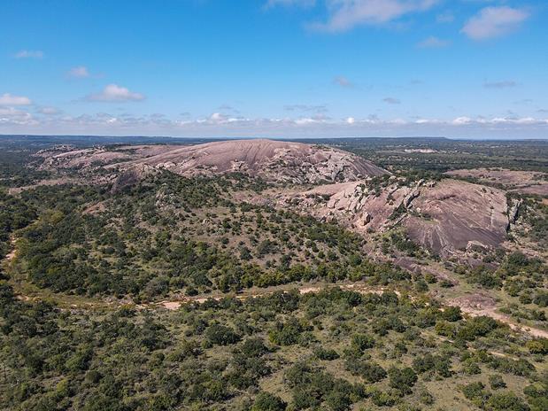
The Towering Pink Dome: Enchanted Rock's Geological Marvel
Rising majestically 425 feet above the surrounding Texas landscape, Enchanted Rock stands as a monument to over one billion years of geological history. This massive pink granite monadnock—the largest pink granite monadnock in the United States—was once molten magma that cooled slowly underground before erosion exposed its impressive dome.
From your aerial vantage point, you'll capture the distinctive granite weathering patterns of this exfoliation dome, where curved layers peel away like an enormous stone onion. The brilliant pink hue comes from the abundant potassium feldspar present throughout the granite.
Look for the specialized ecological microhabitats found in vernal pools that form in the rock's depressions after rainfall. These temporary water features create unique environments for rare plants and animals, adding another fascinating dimension to your aerial photography of this 1,825-foot-high natural wonder.
Sculptural Sand Landscapes of Monahans Sand Hills
In stark contrast to Enchanted Rock's solid granite form, the fluid sand dunes of Monahans Sandhills State Park offer photographers a constantly evolving canvas. This 3,840-acre park features impressive dunes reaching heights of 70 feet, their patterns reshaping almost daily with the seasonal winds.
You'll capture unique dune patterns and their dynamism best during sunrise or sunset when shadows accentuate the sculptural qualities of this landscape. The interplay between stable and shifting sand creates fascinating textures for aerial compositions. Photographers should note that this impressive landscape is merely a fraction of a much larger dune field extending about 200 miles from south of Monahans into New Mexico.
Look for the distinctive Shin oak that anchors the sand with extensive root systems. These small 4-foot trees create mini-forests amid the dunes, adding visual interest to your shots. For wildlife photography, position near water seeps at dawn or dusk when desert creatures emerge.
Rugged Canyon Vistas at Big Bend Ranch
Big Bend Ranch State Park showcases some of Texas' most dramatic terrain, with its rugged canyons carving through ancient volcanic landscapes. From the air, you'll capture stunning contrasts between sunlit cliff faces and shadowed canyon floors that create depth in your photographs. The park sits just to the west of Big Bend National Park, offering complementary but distinct photographic opportunities.
For ideal backcountry exploration, use Fresno Canyon Road to access strategic overlooks, or note that the Big Bend Ranch State Park Airport (3T9) sits at about 4,250 feet in the region for small-aircraft access. Morning and evening flights provide the most dramatic lighting, highlighting varied vegetation patterns against the textured canyon walls.
The park's gold tier Dark Sky status makes night photography exceptional, with canyon silhouettes framing the Milky Way. Custom aerial tours with experienced pilots can take you over remote areas like the Solitario and Devil's Playground, offering perspectives impossible to achieve by foot.
River and Forest Harmony: Aerial Perspectives of Garner State Park
Garner State Park offers a striking contrast to Big Bend's arid landscapes, with the crystal-clear Frio River cutting a sinuous path through lush Hill Country forests. From above, you'll capture the dramatic interplay between the winding waterway and surrounding 1,774 acres of verdant terrain.
For ideal aerial compositions, visit during golden hour when sunlight amplifies the seasonal color changes of Hill Country foliage. Capturing the bald cypress trees when they turn brilliant orange and red in fall creates stunning visual elements. Your drone footage will reveal hidden rock formations and limestone cliffs that aren't visible from ground level. The park's diverse elevations provide excellent launching points for capturing panoramic views where river patterns and forest textures create natural graphic elements.
Time your shoots during different seasons to document how changing water levels expose unique sandbars and secluded pools. Remember to verify drone regulations with Texas Parks & Wildlife before your visit.
Wildlife and Wetlands: Brazos Bend From Above
Nearly 5,000 acres of pristine wetland wilderness await aerial photographers at Brazos Bend State Park, just 50 miles southwest of Houston. From your drone's bird's eye view, you'll capture bottomland forests and lakes that define this unique ecosystem, where alligators are a common sight along the water.
The park's Spanish moss-draped oaks create ethereal patterns when photographed at sunrise, while seasonal ecosystem shifts offer dynamic shooting opportunities—from spring wildflowers to autumn's golden hues. For wildlife enthusiasts, the aerial perspective reveals the natural distribution of alligators, deer, and hundreds of bird species throughout the bottomland forests and coastal prairies. The park is situated along the scenic Brazos River banks, creating stunning visual contrasts between waterways and vegetation.
Focus your lens on 40 Acre Lake for consistent wildlife viewing, but remember to check water levels, which fluctuate throughout the year, changing the wetland's aerial composition.
Desert Oasis: Capturing Balmorhea's Azure Springs
In stark contrast to Brazos Bend's lush wetlands, the azure waters of Balmorhea State Park emerge dramatically from West Texas's arid landscape. This 1.3-acre spring-fed pool creates a striking visual juxtaposition against the Chihuahuan Desert and Davis Mountains backdrop.
Your drone can capture the remarkable historical significance of this site, where CCC-built structures frame waters that have served humans for generations. The constant 72-76°F temperature guarantees year-round aquatic diversity, including the endangered Comanche Springs pupfish swimming in crystal-clear waters. The pool offers an impressive daily flow of about 22-28 million gallons of water from the San Solomon Spring.
For the most compelling aerial shots, position your camera to highlight how the deep blue pool meets the restored ciénegas and desert terrain. Visit during early morning when the water's surface remains undisturbed, perfectly reflecting the surrounding landscape and revealing the 3.5 million gallons of pristine water below.
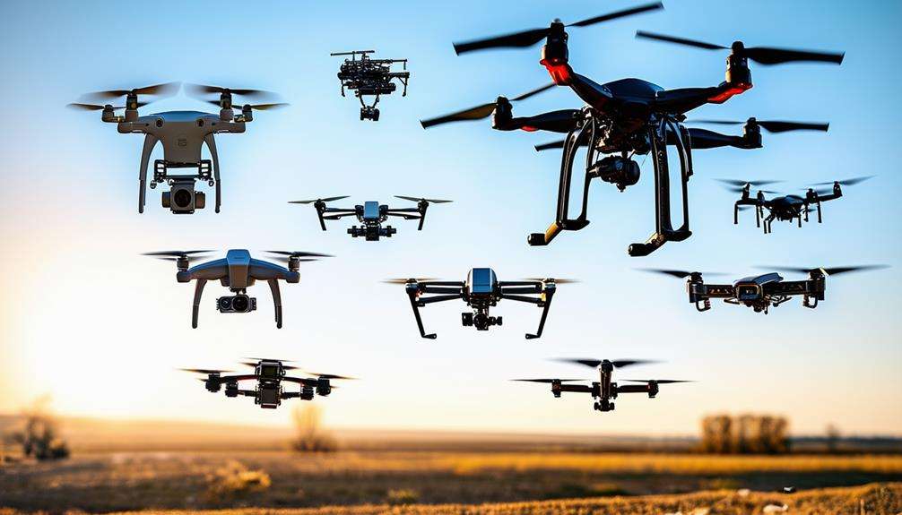
Essential Drone Photography Tips for Texas State Parks
Before launching your drone to capture Texas's diverse landscapes from above, you'll need to navigate a complex web of regulations that govern aerial photography in state parks. Remember that drones are allowed in state parks in two circumstances: Martin Dies, Jr. State Park has a designated area, or you are flying for filming purposes with a filming permit from the park.
Park location selection - Choose your destination strategically, researching which parks allow drone photography and understanding their specific requirements before arriving. Regulatory compliance - Guarantee you're FAA-certified for commercial shoots, have registered your drone if over 0.55 pounds, and have secured written consent when capturing images of private property or identifiable people. Prioritize safety - Keep your drone within visual line-of-sight, use GPS-enabled models with geofencing, and alwa