Drones in Archaeology: Uncovering the Past
Imagine standing on an ancient site, pondering what lies beneath the surface, beyond your reach. Drones in archaeology are transforming this scenario by providing detailed aerial views that uncover hidden structures and landscapes. Utilizing advanced tools like LiDAR (Light Detection and Ranging) and photogrammetry, these methods offer not only efficiency but also a non-invasive approach that respects cultural heritage.
But how do these technologies actually work in practice, and what ethical considerations must be addressed? The future of uncovering the past may be closer than we think, and understanding these aspects is crucial.
Evolution of Drones in Archaeology
The rapid technological advancements in drones have significantly transformed how archaeologists survey and document ancient sites. By offering a unique aerial perspective, drones enable the observation and analysis of archaeological landscapes in ways previously impossible.
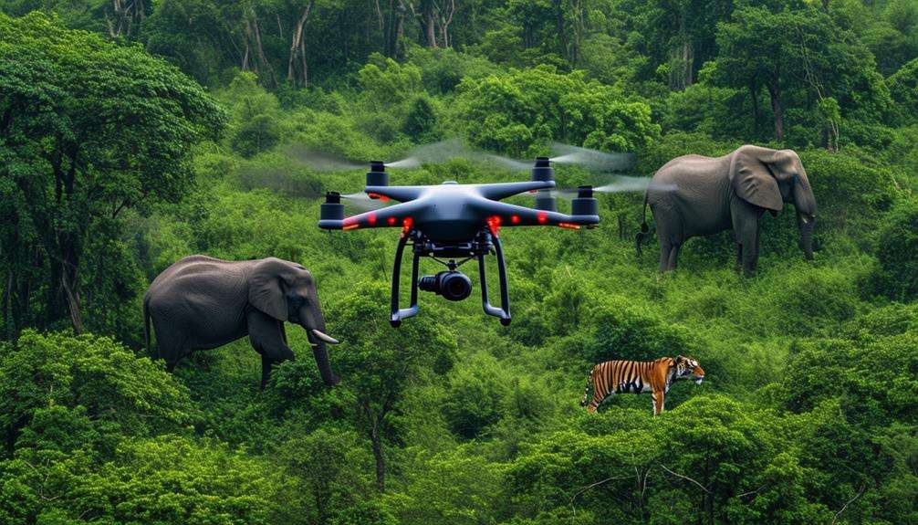
One key technology enhancing this capability is LiDAR (Light Detection and Ranging). LiDAR-equipped drones can penetrate dense vegetation to reveal hidden structures that would otherwise remain undetected. Beyond visual documentation, drones employ advanced remote sensing technologies to collect extensive data, uncovering intricate details about ancient settlements and their environments. This capability is crucial for identifying and preserving sites vulnerable to environmental changes.
The ability of drones to quickly gather and process data allows archaeologists to spend less time on initial surveys and more on in-depth analysis and interpretation. This efficiency is particularly beneficial in challenging terrains where traditional methods are slow and labor-intensive. By integrating drones into the archaeological toolkit, researchers not only enhance their capabilities but also promote greater public engagement and awareness of archaeological discoveries. Drones have become indispensable in modern archaeological exploration.
Aerial Survey Techniques
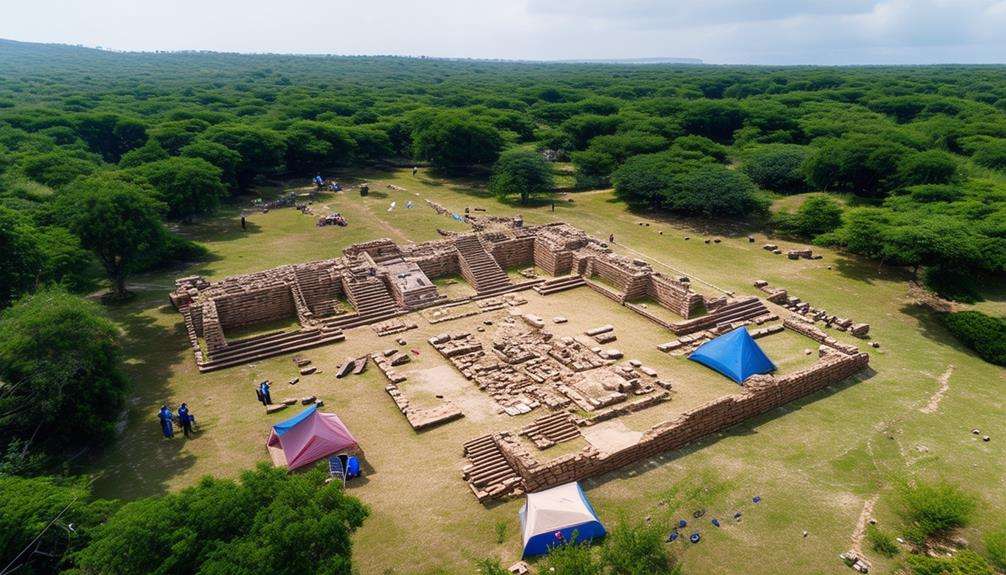
Regularly employing aerial survey techniques, archaeologists can efficiently map ancient landscapes and uncover hidden archaeological sites. Drones enable the capture of high-resolution aerial imagery, revealing intricate details of the terrain. This method is highly effective for identifying archaeological features that might be overlooked from the ground.
Drones equipped with LiDAR technology can create precise 3D maps of archaeological sites. LiDAR scans the landscape with laser pulses, penetrating vegetation and other surface cover to expose features that are otherwise concealed. This non-invasive method ensures that areas can be investigated and documented without disturbance.
Additionally, drones outfitted with thermal sensors can detect anomalies below the Earth's surface. These sensors identify variations in ground temperature, which can indicate buried structures such as walls or foundations. This technology allows for pinpointing potential excavation sites with unparalleled accuracy.
Aerial surveys using drones are transforming archaeological research. By capturing detailed imagery and utilizing advanced technologies like LiDAR and thermal sensing, archaeologists can uncover the secrets of ancient civilizations more efficiently and respectfully than ever before.
Benefits of Drone Technology
Drone technology revolutionizes archaeological site surveys by providing unparalleled high-resolution imagery. These images capture detailed views of large areas quickly, revealing features that might be overlooked when surveying on foot. Drones enable efficient mapping and documentation of sites, thereby enhancing both research and preservation efforts.
Enhanced Site Surveys
By leveraging drone technology, archaeologists can now conduct site surveys with significantly improved efficiency, capturing high-resolution aerial images that provide detailed perspectives previously unattainable. Drones enable the rapid and accurate collection of vast amounts of data, documenting surface features with exceptional precision. Additionally, technologies like LiDAR (Light Detection and Ranging) can be employed to reveal hidden subsurface elements without disturbing the site.
Drones streamline data collection processes, facilitating easier analysis and interpretation of the gathered information. Large areas can be covered in a fraction of the time required by traditional methods, thus conserving valuable resources. Furthermore, drones offer a non-invasive means to investigate cultural heritage sites, minimizing potential damage and aiding in their preservation for future generations.
Environmental monitoring is also enhanced with drone technology, allowing for the tracking of changes over time that might impact archaeological sites. This data is crucial for conservation efforts, enabling informed decisions to protect historical artifacts. Ultimately, incorporating drones into archaeological practices enhances the ability to uncover the past, providing new insights and more accurate reconstructions of ancient landscapes.
High-Resolution Imagery
High-resolution aerial imagery captured by drones provides archaeologists with detailed views that significantly enhance their understanding of archaeological sites and features. By capturing high-resolution images, drones reveal intricate details of ancient landscapes that are crucial for creating accurate 3D models. These models uncover subtle features that might be missed during ground surveys.
A major advantage of drone technology is its ability to utilize advanced imaging techniques like LiDAR. LiDAR can penetrate dense forests and other vegetation, revealing hidden structures and layouts that are otherwise invisible. This capability allows archaeologists to study sites that are difficult to access or heavily overgrown.
The detailed aerial images also aid in understanding the spatial organization of ancient structures. By examining high-resolution visuals, archaeologists can better grasp how ancient communities arranged their buildings, roads, and other features. Additionally, this imagery is invaluable for monitoring environmental changes that might impact these sites. By tracking erosion, vegetation growth, and other factors, proactive steps can be taken to preserve and manage these historical resources.
High-Resolution Imaging
High-resolution imaging enables precise mapping of archaeological sites, documenting artifacts in exceptional detail. The accurate topographical analysis provided by drones reveals subtle features and patterns that were previously overlooked, transforming the study and documentation of archaeological landscapes.
Enhanced Site Mapping
Drones have revolutionized archaeological site mapping by offering unparalleled high-resolution imaging that captures intricate details. Deploying drones over archaeological sites provides access to detailed aerial images that can be transformed into accurate 3D models. These models enhance the visualization of ancient landscapes and their spatial organization. The high-resolution imaging capabilities of drones allow for the detection of subtle features that traditional survey methods might miss.
By monitoring environmental changes over time, drones provide insights into how landscapes and archaeological elements evolve. This is particularly useful for identifying buried structures or artifacts that might not be immediately visible. Moreover, the precision of drone imaging enhances the preservation and documentation of cultural heritage sites, ensuring that valuable information is not lost to time or environmental shifts.
A snapshot of how drones contribute to improved site mapping:
| Benefit | Description | Impact on Archaeology |
|---|---|---|
| High-Resolution Imaging | Captures intricate site details | Improved accuracy in mapping |
| 3D Models | Reconstructs ancient landscapes | Better understanding of spatial organization |
| Environmental Monitoring | Tracks changes over time | Identifies buried elements |
| Cultural Preservation | Documents sites with high precision | Enhances heritage conservation |
Incorporating drones into archaeological research can significantly boost the quality and depth of site mapping, providing invaluable data for both current studies and future generations.
Detailed Artifact Documentation
Leveraging high-resolution imaging, drones provide archaeologists with a powerful tool for capturing detailed documentation of artifacts and archaeological sites. These drones can obtain images that reveal intricate details about artifact characteristics and their current condition, offering insights that might be missed with the naked eye.
Additionally, drones facilitate the creation of accurate and intricate 3D models of artifacts. These models are invaluable for further analysis and can be shared globally with colleagues. The process of building 3D models minimizes the need for physical handling, which is crucial for preserving fragile artifacts and ensuring that preservation efforts are more effective and less invasive.
High-resolution imaging also aids in developing comprehensive digital archives of artifacts. These digital records contribute significantly to long-term conservation and study, as they can be easily stored, accessed, and reviewed.
Precise Topographical Analysis
High-resolution imaging significantly enhances artifact documentation and plays a crucial role in conducting precise topographical analysis of archaeological sites. Utilizing a drone equipped with advanced imaging technology, you can capture detailed aerial images that reveal subtle surface features often missed by traditional methods. This technology enables the creation of accurate 3D maps of terrain and structures, offering a comprehensive view of the site's layout and topographical nuances.
Drone technology enriches the understanding of ancient landscapes. High-resolution images facilitate the study of the spatial organization of archaeological sites, helping identify patterns and relationships among different features. This detailed imaging also aids in site preservation by providing a clear record of current conditions, invaluable for monitoring changes over time.
The integration of drone technology in archaeology provides unprecedented precision in gaining insights into the past. By capturing every contour and elevation, high-resolution imaging offers a richer, more detailed perspective of the terrain, leading to more informed interpretations and decisions in archaeological research. This technological advancement has revolutionized the investigation and understanding of historical heritage.
3D Modeling of Sites
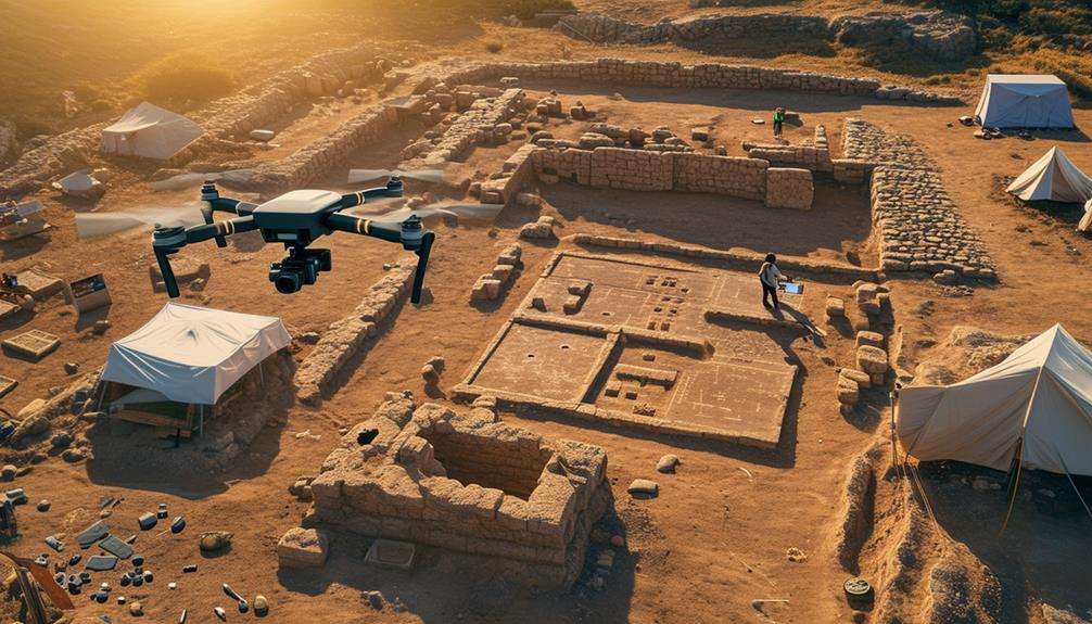
Envision exploring ancient ruins right from your computer screen, made possible by 3D modeling of archaeological sites using state-of-the-art drone technology. Drones equipped with LiDAR and photogrammetry capture high-resolution images and data, enabling the creation of detailed representations of ancient structures and landscapes. These 3D reconstructions allow you to visualize and analyze the spatial organization of historical sites, offering a new perspective on how ancient civilizations lived and interacted with their environment.
Drones fly over archaeological sites, capturing aerial imagery and data that are then processed into precise 3D models. This technology goes beyond aesthetic appeal; it enables detailed investigations into the intricacies of ancient architecture and topography from the comfort of your own home. By examining these models, archaeologists can identify features that mightn't be visible from the ground, providing essential insights for both research and preservation.
Additionally, these 3D models are invaluable for educational purposes, allowing students and enthusiasts to engage with history in an immersive manner. The use of drones in creating these models marks a significant advancement in archaeology, effectively bridging the gap between past and present.
Environmental Monitoring
Drones are crucial for monitoring environmental changes that impact archaeological sites, such as erosion and vegetation growth. By offering a comprehensive aerial perspective, drones can observe and document minor changes over time. This capability is essential for assessing the effects of climate change on cultural heritage and archaeological landscapes. Advanced sensors on drones can detect subtle variations in soil moisture and vegetation patterns that might otherwise go unnoticed.
Environmental monitoring with drones facilitates informed decision-making for site preservation. For example, if increased erosion or shifts in vegetation are detected, targeted conservation measures can be implemented to address these risks. This proactive approach ensures the long-term sustainability and protection of archaeological sites. Additionally, the data collected by drones can provide insights into how current environmental conditions might influence future site stability.
Using drones for environmental monitoring enhances conservation efficiency and offers a non-invasive method to oversee these invaluable sites. By integrating this technology, you contribute to the ongoing efforts to protect our shared cultural heritage from the relentless forces of nature and climate change.
Non-Invasive Exploration
Leveraging the benefits of environmental monitoring, drones can be pivotal for non-invasive exploration of archaeological sites, preserving the integrity of these ancient landscapes. Unmanned aerial vehicles (UAVs) equipped with advanced imaging technology, such as LiDAR, offer a groundbreaking method to uncover buried archaeological features without disturbing the ground.
These UAVs enable the creation of detailed 3D maps of ancient sites, revealing hidden structures and artifacts that might otherwise remain undetected. This crucial exploration facilitated by drones provides archaeologists with significant insights into our past while ensuring the preservation of the sites' physical and cultural heritage.
By flying over these areas and capturing high-resolution images and data, archaeologists can effectively document, monitor, and study archaeological landscapes.
Additionally, the data collected by these drones aids in the prevention of looting and destruction by providing a clear record of the site's layout and significant features. Utilizing UAVs isn't only cost-effective but also a highly efficient method for archaeological exploration. This technology respects the cultural significance of ancient sites and contributes to their long-term preservation.
Case Studies and Discoveries
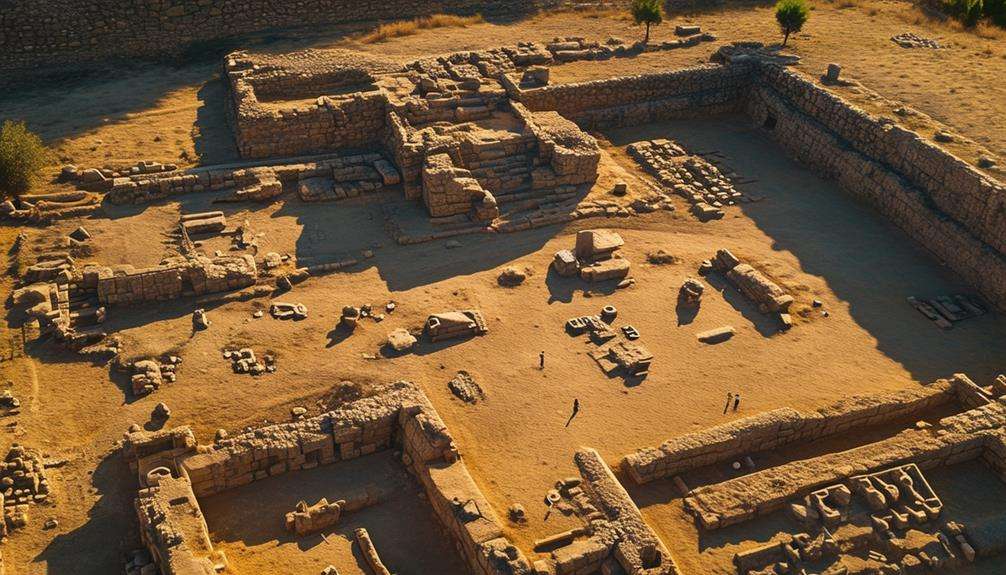
Drones have revolutionized archaeology by mapping ancient sites, such as Roman army encampments and Silk Road outposts, using advanced aerial survey techniques. High-resolution images and LiDAR data have uncovered previously hidden historical artifacts.
Ancient Site Mapping
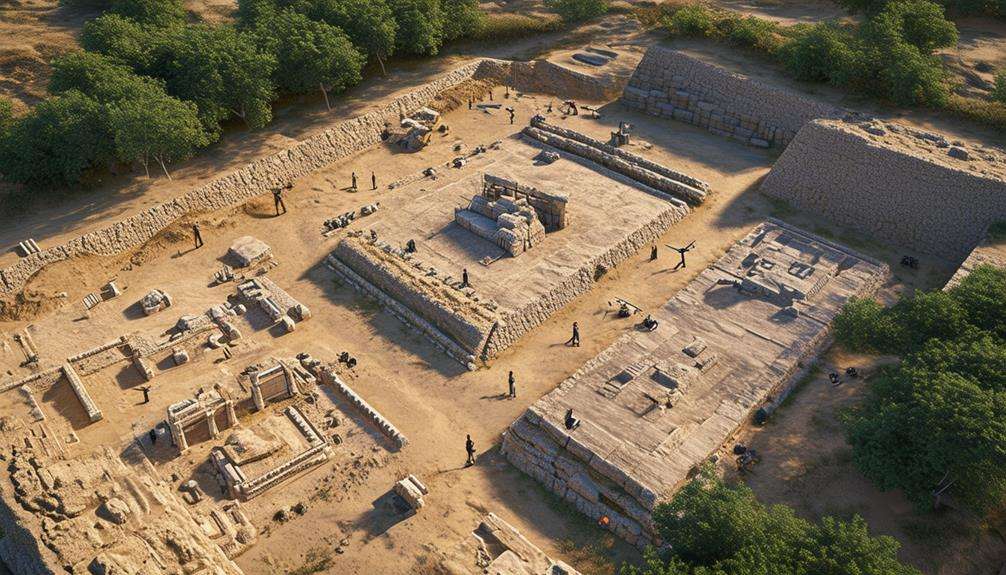
Advancements in drone technology have unveiled previously hidden aspects of ancient sites, leading to groundbreaking revelations in archaeology. Utilizing LiDAR technology, drones have discovered hidden features and ancient structures at various archaeological locations. This aerial mapping has facilitated the revelation of lost civilizations, fortifications, and historical landmarks that were once concealed beneath forests or modern developments.
Consider these three fascinating case studies:
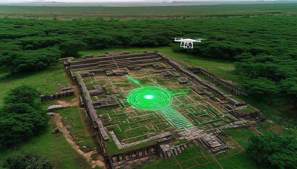
- Maya Civilization: In Guatemala, LiDAR-equipped drones revealed an extensive network of ancient structures, including hidden pyramids and roadways, previously obscured by dense jungle.
- Cambodian Temples: At Angkor Wat, aerial mapping uncovered hidden temples and water systems, providing new insights into the scale and sophistication of the Khmer Empire.
- Scotland's Brochs: Over the Scottish Highlands, drones mapped out Iron Age structures known as brochs, offering detailed 3D models that help archaeologists understand their construction and use.
These discoveries highlight how drones are revolutionizing the mapping of ancient landscapes. By providing detailed 3D models, drones enable archaeologists to conduct thorough analyses and enrich our understanding of historical contexts. With each flight, more hidden gems from our past are expected to come to light, enriching both research and public knowledge.
Aerial Survey Techniques
In recent years, aerial survey techniques using drones have significantly transformed archaeology by unveiling hidden features and ancient sites worldwide. Leveraging drone imagery and high-resolution images, archaeologists have discovered ancient civilizations, fortresses, and encampments previously unknown.
For instance, drones equipped with LiDAR technology have mapped out lost Silk Road outposts, caravanserais, and subterranean canals in Afghanistan, providing intricate details of these ancient trade networks.
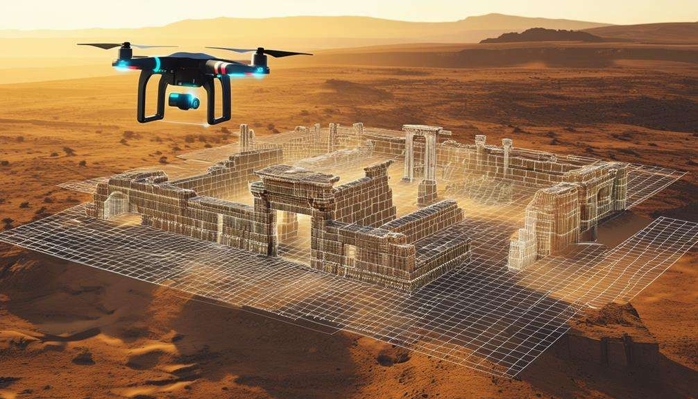
Combining satellite data with drone imagery has proven invaluable for locating shipwrecks, pre-colonial settlements, and ancient fortifications. This approach has led to remarkable findings, such as walled Garamante towns, villages, and farms in the Sahara Desert, offering insights into the lives of ancient desert dwellers.
The capability to capture high-resolution images from above allows detection of features like wooden towers, Roman army encampments, and ancient Parthian civilizations with unprecedented clarity.
In essence, aerial survey techniques harness modern technology to reveal historical layers, enabling the study of the past in ways once unimaginable. These advancements are revolutionizing archaeology and redefining our understanding of human history.
New Archaeological Findings
Drone technology, especially when integrated with LiDAR, has revolutionized archaeology by uncovering hidden sites and long-lost civilizations, resolving some of the field's most compelling mysteries.
- Maya City in Mexico: A drone survey equipped with LiDAR technology revealed a hidden Maya city in the dense Mexican jungle. The detailed structures and sophisticated urban planning discovered have provided new insights into the cultural practices of the ancient Maya civilization.
- Geoglyphs in Peru: In Peru, drones have identified over 50 previously unknown geoglyphs. These discoveries have enhanced our understanding of ancient civilizations and the symbolic meanings behind these large-scale ground drawings.
- Ancient Roads in Greece: Drones have mapped an intricate network of ancient roads in Greece, showcasing the advanced infrastructure of past societies. These roads highlight the connectivity and sophistication of ancient Greek civilization.
Additionally, drones have uncovered hidden burial sites and tombs in Egypt, offering a clearer picture of ancient burial practices. In the UK, drone mapping of Stonehenge has provided new perspectives on its construction and alignment with celestial bodies. These case studies demonstrate that drones aren't merely tools but are revolutionizing the quest to uncover the past.
Ethical Considerations
Exploring the ethical considerations of drone use in archaeology ensures the safeguarding of cultural heritage and the honoring of local communities. Responsible drone usage requires obtaining the necessary permits and respecting the privacy of individuals and sites. It's crucial to avoid any damage to archaeological sites, and adhering to ethical codes guarantees the preservation of historical landmarks and the collection of accurate data.
Legal requirements dictate where and how drones can be flown near archaeological sites. These regulations are crucial to prevent disturbances and ensure compliance with national and local laws. By following these guidelines, you help protect invaluable cultural assets.
Balancing technological advancements with ethical considerations is essential for sustainable archaeological exploration. It's important to consider the impact of your actions on both the environment and the people who've deep connections to these historical sites. Prioritizing ethical considerations not only contributes to the preservation of our shared cultural heritage but also fosters goodwill with local communities. In essence, your commitment to ethical drone use in archaeology upholds the integrity of the field and ensures that the stories of our past are preserved for future generations.
Future Prospects
Looking ahead, advancements in drone technology are set to revolutionize archaeological research, uncovering hidden aspects of our past. By integrating AI and machine learning with LiDAR technology, the identification of previously challenging archaeological features can be automated. This will lead to more efficient data processing and site analysis, saving both time and resources.
Visualization technologies such as VR and AR are enhancing the presentation of 3D models created through LiDAR, making it easier to comprehend and interpret complex archaeological sites. These technologies provide immersive and interactive experiences, transforming how we engage with historical data.
Here are three exciting future prospects:
- Automated Site Analysis: AI and machine learning will swiftly identify and interpret archaeological features from LiDAR data.
- Enhanced Visualizations: VR and AR technologies will allow for the examination of 3D models of archaeological sites in unprecedented detail.
- Collaborative Efforts: Collaboration among industry professionals, researchers, and governments will address ethical considerations and optimize the benefits of these technologies.
These advancements promise a more profound understanding of our history while ensuring ethical and efficient research practices.
Conclusion
By adopting drone technology, you're entering a new era of archaeological exploration. Drones allow you to uncover hidden structures, create precise 3D models, and conduct non-invasive investigations efficiently.
High-resolution imaging from drones enhances your understanding of ancient sites while preserving their cultural integrity. As drone technology advances, your archaeological endeavors will yield even greater insights and discoveries. Equip yourself with drones and explore uncharted territories of our past.