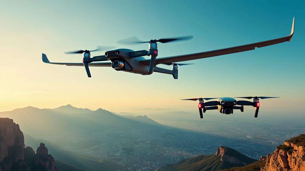
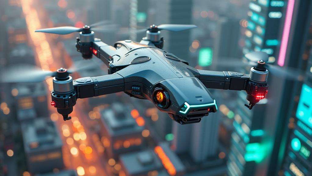
Exploring UAV Payloads: Cameras, Sensors, and Beyond
UAV payloads encompass a wide array of advanced technologies, including high-resolution cameras and sophisticated sensors. These payloads are not only used for capturing stunning aerial imagery but also play a critical role in various applications such as environmental monitoring and military intelligence. For instance, UAVs equipped with LiDAR can precisely map intricate terrains, while multispectral sensors can monitor crop health in real-time. As technology progresses, the potential applications for UAV payloads are expanding rapidly. Interested in how these innovations are transforming industries and what the future may hold? Let's delve deeper.
Definition of UAV Payloads
UAV payloads refer to the additional equipment that drones carry, such as sensors, cameras, and other devices required for specific missions beyond basic flight. These payloads are crucial for broadening the capabilities of drones, allowing them to undertake various tasks ranging from aerial photography to intricate data gathering.
A key aspect to consider is the payload capacity of a UAV. For instance, the DJI Matrice 350 RTK can support a maximum payload of 2.7 kg. Adhering to this limit is essential to prevent overloading, which could compromise flight stability and battery performance. Proper management of payloads, such as thermal imaging cameras, is vital for providing real-time data during operations, thereby enhancing mission effectiveness.
The power-to-weight ratio is another critical factor. A higher ratio enables the drone to carry more sophisticated technology and sensors while maintaining optimal performance and efficiency. Balancing the payload weight with the drone's capabilities ensures efficient and successful operations.
Understanding these elements is essential for leveraging UAV payloads effectively, ensuring that drone missions are both efficient and successful.
Types of UAV Payloads
UAV payloads encompass a range of specialized tools designed for distinct applications. Imaging and mapping payloads, such as high-resolution cameras and LiDAR systems, deliver vital data for tasks including search and rescue and topographic mapping. Communication payloads and environmental monitoring sensors enhance emergency response and environmental data collection, offering real-time capabilities and precise measurements.
Imaging and Mapping Tools
Imaging and mapping tools are essential UAV payloads, offering unmatched precision and versatility for a range of applications. High-resolution aerial survey cameras like the Zio Gimballed 4K Camera capture detailed visual data crucial for urban planning and infrastructure inspection, providing a comprehensive view of complex environments.
For topographic mapping and environmental monitoring, LiDAR solutions such as the YellowScan Surveyor Ultra significantly enhance data collection capabilities by delivering precise, three-dimensional maps. Thermal imaging payloads like the DJI Zenmuse H20 detect heat signatures in real time, making them indispensable for search and rescue missions and industrial inspections.
Specialized imaging systems, including MWIR cameras, provide high-resolution capabilities for security surveillance and situational awareness in various environments. Advanced gimbal systems like the Gremsy T7 ensure camera payloads remain stable during flight, providing clear and consistent imaging quality across diverse operational scenarios.
Environmental Monitoring Sensors
Environmental monitoring sensors integrated into UAVs are pivotal for a wide range of applications, such as evaluating vegetation health, detecting hazardous substances, and monitoring land use. Multispectral and hyperspectral cameras capture data across various wavelengths, enabling you to assess vegetation health, monitor land use, and evaluate water quality. LiDAR technology, from companies like YellowScan and RIEGL, offers precise 3D representations of terrain and vegetation, making it invaluable for topographic mapping and forest inventory.
Thermal imaging payloads, such as the FLIR VUE TZ20, excel at detecting heat anomalies. These thermal cameras are essential for wildlife tracking, building inspections, and identifying heat loss in structures. Gas sensors, like US Nuclear's DroneRAD, monitor air quality and detect hazardous substances, proving crucial for environmental assessments and emergency responses.
Advanced acoustic sensors can be mounted on drones to monitor wildlife sounds and detect environmental changes, providing valuable data for conservation and ecological studies. By leveraging these diverse sensor capabilities, you can address various environmental monitoring challenges effectively.
Communication and Delivery Payloads
Unmanned Aerial Vehicles (UAVs) are transforming operations in remote and challenging environments through advanced communication and delivery payloads. For instance, the CZI LP12 Spotlight & Loudspeaker for the DJI Matrice 30 provides significant support for law enforcement by enabling audio broadcasting up to 200 meters and visual illumination for up to 100 meters. These features are essential for coordinating operations and ensuring public safety.
Real-time data transmission is another critical aspect of communication payloads. These systems facilitate seamless coordination and enhance situational awareness for first responders by providing immediate information. In emergency scenarios, access to up-to-the-minute data can be life-saving.
Delivery payloads further extend the capabilities of UAVs. Specialized delivery systems, such as those on the DJI FlyCart 30, enable the transport of essential items like medical supplies or food to inaccessible areas. With the capacity to handle up to 40 kg using a 20-meter winch, these UAVs can deliver critical supplies mid-flight, significantly improving response times in crisis situations.
ISR Applications
In ISR applications, UAVs are equipped with advanced surveillance tools, including high-sensitivity SWIR and MWIR cameras, which excel in low-light and varied operational environments. These reconnaissance capabilities are further enhanced by technologies like LiDAR and EO/IR systems, enabling detailed mapping and real-time monitoring. Leveraging these tools provides military and security agencies with a significant tactical advantage.
Essential Surveillance Tools
In Intelligence, Surveillance, and Reconnaissance (ISR) operations, having the right tools is paramount. High-sensitivity cameras like the SenS 1280 and NoxCam-Pola are critical for capturing detailed aerial images, providing superior data for mapping and monitoring tasks. These cameras deliver crystal-clear visuals, ensuring no critical details are overlooked during surveillance.
Thermal cameras, such as the NoxCore series, are indispensable for nighttime missions and infrastructure inspections. These devices detect heat signatures, making it possible to monitor environmental conditions and identify anomalies invisible to the naked eye.
EO/IR payloads, like the Vio EO/IR and TrakkaCam systems, combine electro-optical and infrared imaging capabilities, making them versatile tools for diverse ISR applications. They offer dual imaging functionalities, ensuring effective surveillance regardless of the time of day or weather conditions.
Here's a quick comparison of some key ISR tools:
| Payload Type | Example Models | Key Applications |
|---|---|---|
| High-Sensitivity Cameras | SenS 1280, NoxCam-Pola | Mapping, Monitoring |
| Thermal Cameras | NoxCore series | Nighttime Surveillance, Inspections |
| EO/IR Systems | Vio EO/IR, TrakkaCam | Aerial Surveillance, Environmental Assessments |
These specialized imaging systems provide high-resolution situational awareness, crucial for successful ISR operations. By leveraging these tools, you ensure comprehensive and reliable intelligence collection, essential for informed decision-making.
Enhanced Reconnaissance Capabilities
Maximizing reconnaissance capabilities in ISR (Intelligence, Surveillance, and Reconnaissance) applications requires leveraging cutting-edge payloads tailored for diverse operational needs. By integrating advanced cameras and sensors with drones, unparalleled situational awareness can be achieved. High-sensitivity SWIR (Short-Wave Infrared) cameras like the SenS 1280 enhance object detection and tracking, even in challenging light conditions, thereby boosting operational effectiveness.
The power of EO/IR (Electro-Optical/Infrared) payloads, such as Vio EO/IR systems, cannot be overlooked. These systems combine electro-optical and infrared imaging to enable comprehensive monitoring of environments, whether day or night. This capability provides a significant advantage by ensuring detailed surveillance in both well-lit and low-light scenarios, leaving no detail unnoticed.
Flight dynamics also play a crucial role in ISR missions. Integrating sophisticated imaging systems with drones allows for rapid data collection over expansive areas, significantly reducing the time needed for ground assessments and increasing mission efficiency.
LiDAR (Light Detection and Ranging) solutions, including YellowScan and RIEGL scanners, offer precise topographic mapping and environmental monitoring. These tools provide essential data for strategic planning and execution, enhancing the ability to make informed decisions quickly. By leveraging these advanced technologies, ISR operations can be both efficient and effective.
Advanced Mapping Technologies
Advanced mapping technologies are transforming ISR (Intelligence, Surveillance, and Reconnaissance) applications by offering unmatched precision and efficiency. UAVs equipped with LiDAR systems, such as YellowScan and RIEGL scanners, provide high-resolution topographic data essential for environmental monitoring and urban planning. Additionally, specialized imaging systems like Vio EO/IR and TrakkaCam facilitate comprehensive aerial surveillance and environmental assessments under various conditions.
Integrating SWIR cameras, such as the SenS 1280, extends imaging capabilities beyond the visible spectrum, thereby enhancing analytical precision for mapping and surveying. UAVs with these advanced payloads can conduct photogrammetry, generating accurate 3D models and maps crucial for infrastructure inspection and land management.
Aerial survey cameras, including the C5C30, enable extensive data collection, significantly reducing the time and effort required by traditional survey methods. This efficiency is particularly advantageous for applications in agricultural monitoring and disaster response.
| Technology | Application |
|---|---|
| YellowScan LiDAR | Environmental Monitoring |
| Vio EO/IR | Aerial Surveillance |
| SenS 1280 SWIR | Advanced Imaging |
| C5C30 Camera | Agricultural Monitoring |
These technologies collectively enhance the capabilities of UAVs, making them indispensable tools for modern ISR operations.
Integration and Communication
Effective UAV payload integration and communication are crucial for mission success. Utilizing UAV payload integration services ensures that your aircraft's payloads are perfectly aligned with your specific mission objectives and operational needs. Communication protocols like MAVLink and UAVCan are essential for seamless integration, facilitating compatibility checks that include PWM signals for servos and motors.
Focusing on effective payload integration enhances operational efficiency by ensuring that your autopilot systems and payloads work in harmony, thereby improving mission success rates. Custom software development also plays a significant role, providing the necessary documentation and support for smooth integration processes.
Careful evaluation of weight distribution and power requirements is vital for proper payload management. Improper integration can lead to reduced flight stability and performance, jeopardizing your mission. Proper integration ensures your UAV can perform at its best, maintaining balance and efficiency.
Payload Management Software
Payload management software is essential for optimizing UAV payload integration and operation, ensuring the drone systems align with mission objectives. It enables real-time data processing and seamless communication between the drone's autopilot systems and its payloads, often using protocols like MAVLink or UAVCan. This ensures effective management of different payloads, enhancing the UAV's operational efficiency.
Custom software solutions support specific payload functionalities tailored to unique needs. These solutions often include detailed documentation for troubleshooting and upgrades, ensuring the UAV maintains peak performance. Effective payload management software also allows for close monitoring of payload performance. Adjusting weight distribution helps maintain flight stability and efficiency, crucial for optimizing flight duration.
Many modern UAV platforms come with built-in payload management systems that automatically adjust to varying payload weights and types during flight. This adaptability enhances the flexibility of the drone and maximizes its operational capabilities. With robust payload management software, a wide range of missions can be confidently tackled, knowing the UAV is optimized for performance and reliability.
Advanced Imaging Solutions
Leveraging advanced imaging solutions for UAVs significantly enhances their utility across various applications. High-resolution aerial survey cameras, such as the Zio Gimballed 4K Camera, provide detailed visual data crucial for mapping and monitoring projects. These cameras capture sharp, precise images, making them indispensable tools for urban planning, agriculture, and environmental conservation efforts.
Thermal imaging payloads, such as the DJI Zenmuse H20, are another cornerstone of advanced imaging solutions. Combining dual thermal and RGB sensors, these payloads enable real-time imaging, vital for public safety and industrial inspections. Whether assessing structural integrity or conducting search and rescue operations, thermal imaging payloads offer unparalleled situational awareness.
LiDAR scanners like the RIEGL VQ-840-G and YellowScan Surveyor Ultra add precision to topographic and bathymetric surveys, enhancing environmental monitoring through accurate terrain mapping and waterway analysis. Compact MWIR cameras and gimbal systems, such as the Gremsy T7, provide stability and high-resolution imaging essential for aerial surveillance in challenging conditions.
Specialized gimbals and underwater imaging solutions, like the Awarion Maritime System, further expand UAV capabilities in maritime and urban environments. By integrating these advanced imaging solutions into UAV operations, new heights in data accuracy and operational efficiency can be achieved.
Future Trends in UAV Payloads
As we look to the future, several emerging trends in UAV payloads promise to revolutionize the industry. Multi-spectral and hyperspectral cameras are at the forefront, offering unparalleled capabilities in environmental monitoring and precision agriculture. These advanced imaging technologies will enable the collection of more detailed data, enhancing decision-making processes in real time.
AI-powered payloads are another significant development. By integrating AI into UAV systems, data can be processed and analyzed on the fly, allowing for immediate decision-making and improved mission outcomes. Envision deploying a drone that not only captures data but also interprets it instantly, providing actionable insights without requiring a ground-based analyst.
Lightweight materials are also set to transform UAV payload capacities. These materials can improve drone efficiency, allowing for heavier or more advanced payloads without sacrificing flight time or performance. This enhancement means you can carry more sophisticated equipment or extend your operational range.
Autonomous UAVs are driving demand for specialized payloads capable of performing complex tasks like infrastructure inspection and disaster response independently. As these technologies evolve, UAVs will become more versatile, efficient, and indispensable across various sectors.