A Drone Travel Calendar for Capturing Texas From Above

Texas gives you something worth shooting every single month—but knowing when to fly matters just as much as knowing where. Light conditions, seasonal weather, and regional landscapes shift constantly, and timing your flights around those changes is what separates average footage from standout aerial work.
Drones made it possible for anyone to capture cinematic views, but consistency comes from planning. By aligning your flights with seasonal patterns—from wildflower blooms to winter fog—you turn random flights into a structured visual strategy. What follows isn’t just a guide—it’s a working calendar you can use to capture Texas at its best all year long.
The Real Reason Texas Drone Photography Rewards Every Type of Pilot
Texas stands out because of its sheer variety. Within a single state, you can capture dense urban skylines, desert terrain, coastal wetlands, and forest canopies. That diversity makes it one of the most rewarding places to build both a creative portfolio and a consistent shooting routine.
For content creators, this means you never run out of material. Each region offers a different visual identity, and seasonal changes make locations feel new throughout the year. A lake in summer reflects bright skies and activity, while the same location in winter may offer fog, stillness, and minimal color.
For professionals, this variety also translates into demand. Real estate, tourism, agriculture, and local businesses all rely on aerial visuals. The same drone that captures cinematic travel content can also be used for client work, making Texas an ideal environment for both creative and commercial growth.
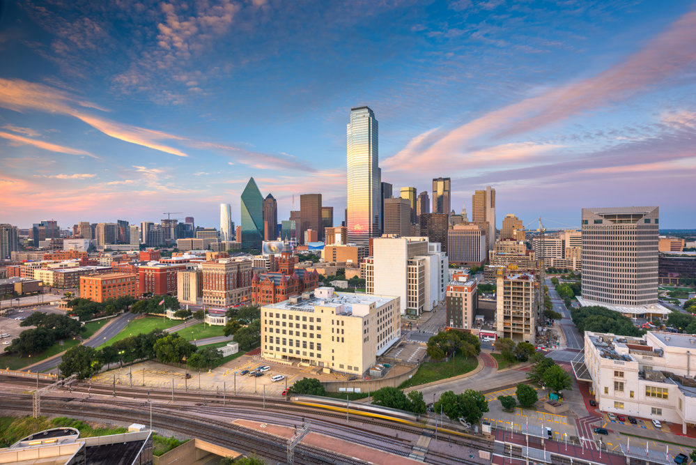
Your Month-by-Month Texas Drone Flight Calendar
This is where planning becomes practical. Instead of flying randomly, use seasonal patterns to guide your schedule.
January – February (Winter)
- Best for: fog, minimal crowds, clean skylines
- Locations: Dallas, Austin, Houston
- Early morning flights often produce mist and soft light, ideal for atmospheric footage
March – April (Spring)
- Best for: wildflowers, greenery, balanced lighting
- Locations: Texas Hill Country, Austin outskirts
- Bluebonnet season creates some of the most recognizable Texas visuals
May – June (Early Summer)
- Best for: lakes, rivers, outdoor activity
- Locations: Lake Travis, Lake Lewisville
- Shoot early mornings to avoid harsh midday light and heat distortion
July – August (Peak Summer)
- Best for: sunrise/sunset silhouettes, water reflections
- Locations: coastal areas, reservoirs
- Avoid midday—heat and haze are at their worst
September – October (Fall Transition)
- Best for: softer light, changing foliage in East Texas
- Locations: Tyler, Nacogdoches
- More consistent lighting makes this one of the easiest shooting seasons
November – December (Late Fall/Winter Return)
- Best for: urban lights, holiday visuals, clear skies
- Locations: major cities
- Shorter days mean tighter golden hour windows—but stronger contrast
This rotation ensures your content evolves naturally instead of repeating the same visuals year-round.
The Best Texas Cities to Capture From Above
Texas gives drone pilots an embarrassment of riches when it comes to striking aerial subjects, and knowing where to point your lens separates forgettable footage from standout work. From Riverfront Vistas along Buffalo Bayou to Rooftop Geometry crowning San Antonio's pedestrian zones, every city delivers something distinct.
Target these five destinations:
- Dallas – Trinity River spillway, Margaret Hunt Hill Bridge illumination, and Reunion Tower's 470-foot skyline surround
- Houston – Allen Parkway high-rises framed against Eleanor Tinsley Park
- Austin – Lou Neff Point, Doug Sahm Hill, and Pfluger Pedestrian Bridge for layered skyline shots
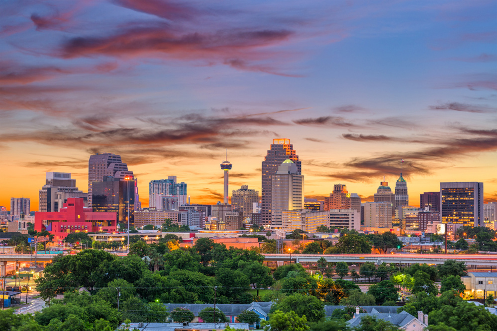
- San Antonio – elevated urban architecture with walkable foreground detail
- El Paso – West Texas desert framing a compact downtown from above
Keep in mind that 95% of Texas is privately owned, so always secure landowner permission before launching over any non-park or non-urban private property.
East Texas Drone Shots Worth Adding to Your Location List
East Texas doesn't grab the same headlines as Dallas or Austin, but it rewards drone pilots who seek it out with something those cities can't offer: dense piney woods, reservoir-edged horizons, and quiet rural geometry that reads beautifully from altitude.
Tyler anchors the region as a reliable base for operations, and surrounding areas deliver historic downtowns, river bends, and sprawling landscapes that hold up across every lighting condition. You'll want to schedule shoots around golden hour, when the canopy texture deepens and waterways catch the light.
Local services like East Texas DroneLogic and 360 Media operate throughout the region, so you can coordinate professional pilots without logistical friction. Add these locations early — East Texas rewards the planners who get there before the crowds do.
Coverage extends well beyond Tyler into communities like Lufkin, Nacogdoches, Huntsville, and Texarkana, giving aerial photographers a wide corridor of distinct landscapes to work across. Professional drone operators serving the region are FAA-certified expert pilots who deliver fully edited imagery within 24 hours of a shoot.
Create your own travel calendar to plan adventures and remember important trip dates.
The Right Camera Settings for Texas Heat, Haze, and Flat Light
Shooting drone footage across Texas means wrestling with three distinct optical challenges that can ruin otherwise strong compositions: intense heat, atmospheric haze, and flat midday light. Dialing in the right settings keeps your footage sharp and properly exposed across all three conditions.
- Use an ND filter (ND8 for haze, ND16 for intense sun) to control exposure without sacrificing shutter speed
- Set ISO 100–200 to eliminate noise in bright, diffused light
- Lock manual focus to infinity to cut through heat shimmer
- Shoot in RAW format so you can correct color casts and haze in post
- Adjust white balance using daylight or a custom preset to neutralize flat, washed-out tones
Midday Texas sun rewards precise settings, not guesswork. When shooting in automatic modes, use EV compensation to fine-tune overall brightness without disrupting your manually locked focus or white balance settings.
FAA Part 107 Requirements Every Texas Drone Pilot Must Know
Before you launch a single flight in Texas, you've got to understand FAA Part 107—the federal framework that governs every commercial and recreational drone operation in the country. These FAA basics apply whether you're shooting Big Bend at sunrise or capturing Houston's skyline.
The certification process starts with creating an IACRA profile to get your FAA Tracking Number, then passing a 60-question Aeronautical Knowledge Test at a PSI center for $175. Once approved, you'll receive your Remote Pilot Certificate—keep it accessible during every flight.
Operationally, you must maintain visual line of sight, stay below 400 feet in uncontrolled airspace, yield to all other aircraft, and register any drone over 0.55 lbs. Remote ID broadcasting has been mandatory since September 16, 2023. Hobbyist pilots, while not required to hold a Part 107 certificate, must complete the TRUST test and follow FAA recreational model aircraft rules before flying.
How to Hire a Texas Drone Photographer and What to Expect
Once you've got your FAA Part 107 knowledge locked in, the next step is finding the right professional to handle your aerial project. Use platforms like GigSalad to locate licensed Texas drone photographers and apply this hiring checklist for pricing transparency and confidence:
- Search city-specific listings in Houston, Austin, or DFW
- Review portfolios, demo reels, and available photo packages
- Check client reviews for reliability and service quality
- Verify FAA Part 107 certification and full insurance coverage
- Message providers directly to confirm pricing and project scope
Packages typically start at $150–$199, depending on flight time, editing, and location complexity. Always request itemized quotes covering venue, footage type, and specific shots. Book through secure platforms that handle communication, payment, and project confirmation. Austin-based providers like Texas Drone Solutions can often accommodate projects with as little as 24–48 hours notice, making last-minute aerial shoots more accessible than many clients expect.
How Seasonal Weather Shapes Drone Footage in Texas
Weather in Texas isn’t just a challenge—it’s an opportunity. Each season introduces conditions that can dramatically change how a location looks from above, often turning familiar landscapes into entirely different visual experiences.
Winter, for example, brings cooler air and early-morning fog that can soften harsh lines and create layered depth across cityscapes and rural areas alike. A skyline that looks ordinary at midday can feel cinematic when partially obscured by mist. In spring, shifting weather patterns introduce dynamic cloud formations, storms rolling across open land, and vibrant greenery that adds contrast and movement to wide aerial shots.
Summer presents a different kind of challenge—and opportunity. Strong sunlight creates high contrast and sharp shadows, which can either flatten an image or give it bold definition depending on how it’s used. Fall, by contrast, is often the most forgiving season. Lighting becomes softer and more consistent, colors deepen slightly, and weather patterns stabilize, making it easier to plan and execute reliable flights.
Understanding these seasonal shifts allows you to anticipate visual outcomes rather than react to them. Instead of hoping for good conditions, you begin to plan for specific effects—fog for atmosphere, storms for drama, or clear skies for precision. Over time, weather stops being a limitation and becomes one of the most powerful creative tools available to you.
Building a Consistent Drone Travel Routine
Consistency is what turns occasional flights into a strong body of work. Without structure, drone photography can easily become random—capturing moments without building toward anything cohesive. A routine changes that by giving direction to when, where, and how you shoot.
A calendar-based approach helps organize your flights around both time and intention. Planning monthly location targets ensures variety, while seasonal themes help you capture how environments change throughout the year. For example, one month might focus on urban skylines, while another highlights natural landscapes or water-based shots. Pairing these themes with specific shot types—like top-down compositions, tracking shots, or wide reveals—adds another layer of consistency to your work.
This structure doesn’t limit creativity—it supports it. By removing the uncertainty of what to shoot next, you can focus more on how to shoot it. Over time, patterns begin to emerge. You start to recognize which conditions produce the best results, which locations work in specific seasons, and how different variables interact.
Conclusion
Capturing Texas from above isn’t just about having the right equipment—it’s about understanding timing, seasons, and location dynamics. Drones have made aerial photography accessible, but consistency comes from planning.
A structured drone travel calendar turns scattered flights into a cohesive visual strategy. It allows you to capture the state’s full range—from urban skylines to quiet forests—while adapting to changing conditions throughout the year. In the end, the advantage doesn’t come from flying more—it comes from flying with purpose.