San Antonio Views Worth Capturing with a Drone
You'll find San Antonio offers a variety of scenic perspectives—from urban waterways to elevated overlooks—that translate well into aerial photography.
Popular spots include Woodlawn Lake’s reflective shoreline, The Grotto sculpture along the Museum Reach, and Comanche Lookout Park’s elevated views.
However, much of the city sits within controlled airspace near San Antonio International Airport, and drone use is prohibited in National Park Service sites like the San Antonio Missions.
Always check tools like B4UFLY or LAANC authorization apps before flying, and follow FAA guidelines to capture legal and responsible footage.
San Antonio's Class C Airspace and Park Permit Requirements
Flying a drone in San Antonio requires understanding Class C controlled airspace, which surrounds San Antonio International Airport and affects large portions of the city.
You may need FAA authorization (via LAANC or FAA DroneZone) before flying in many urban parks, including areas like Phil Hardberger Park and Denman Estate Park.
FAA rules to follow:
- Maximum altitude of 400 feet above ground level
- Maintain visual line of sight
- Avoid flying over crowds or near emergency operations
- Register drones over 0.55 pounds and complete TRUST certification
Local park rules may vary, so always confirm whether launching and landing drones is allowed at your specific location.
Drone-Friendly Launch Locations with Legal Access
Finding legal and practical launch points is essential when flying in San Antonio’s controlled airspace and park systems.
Several areas offer more accessible launch conditions, provided you follow FAA rules and local guidelines:
Phil Hardberger Park (East & West) – Open spaces and wide trails make this one of the most popular drone-friendly parks. Portions fall within controlled airspace, so LAANC authorization is typically required.
- Woodlawn Lake Park – Large open water and clear sightlines make it ideal for reflection shots, though you should fly early mornings to avoid crowds.
- Olmos Basin Park – Expansive fields and fewer vertical obstacles provide safer flying conditions, especially for beginners.
- Comanche Lookout Park – Elevated terrain offers excellent launch points, but always monitor wind exposure at higher elevations.
- Southside Lions Park (near Mission Reach) – A good alternative near the river corridor, since National Park Service areas prohibit drone use, but nearby city parks may allow it.
Always confirm current restrictions using B4UFLY or LAANC apps, and avoid flying over crowds, roads, or restricted government property.
Mission San Juan and Spanish Colonial Architecture Spots
San Antonio’s most iconic historic sites come with the strictest drone restrictions.
Drone use is prohibited within San Antonio Missions National Historical Park, which includes:
- Mission Concepción
- Mission San José
- Mission San Juan
- Mission Espada
These sites are protected under National Park Service regulations, meaning drones cannot be launched, landed, or operated within park boundaries.
Nearby Stinson Municipal Airport also creates additional airspace considerations south of downtown.
For aerial-style visuals, consider filming from legal areas outside park boundaries or capturing elevated ground-based shots instead.
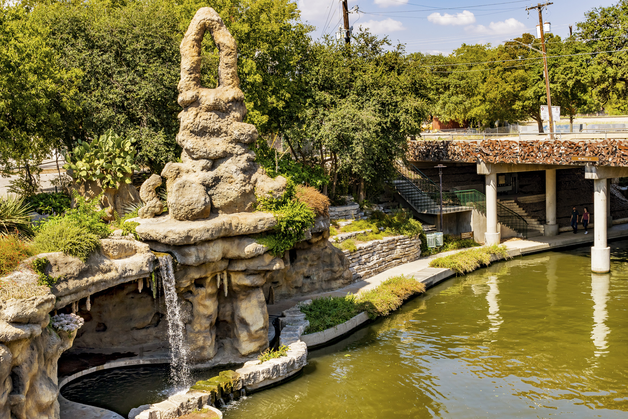
River Walk Grottos and San Pedro Creek Corridors
San Antonio’s Museum Reach section of the River Walk offers visually striking subjects for photography, particularly The Grotto, a large sculptural installation by artist Carlos Cortés.
This multi-level concrete artwork features:
- Carved faces and cave-like textures
- Integrated waterfalls and shaded structures
- Dramatic lighting at night
Nearby, the San Pedro Creek Culture Park provides another scenic corridor with restored waterways, public art, and walkable paths.
While drone use may be restricted depending on airspace and city rules, these areas still offer strong visual composition opportunities from permitted locations.
Woodlawn Lake and Denman Estate Pond Reflections
Woodlawn Lake Park on San Antonio’s west side offers open space and reflective water that can create clean, symmetrical compositions.
The park includes:
- A central lake with skyline reflections
- Walking paths and tree-lined edges
- Open areas suitable for safe flight—where permitted
Denman Estate Park, located in northwest San Antonio, features:
- A scenic pond with a Japanese-style pavilion
- Landscaped walking paths and bridges
- Quieter surroundings compared to busier parks
Both locations require checking local regulations and airspace restrictions before flying.
Olmos Basin and Natural Parks for Trail Footage
Olmos Basin Park provides a mix of open fields and creek corridors, making it useful for capturing wide-angle landscape shots.
Nearby green spaces like Crownridge Canyon Natural Area and Friedrich Wilderness Park feature:
- Native vegetation and Hill Country terrain
- Trail systems that create natural leading lines
- Elevated viewpoints for landscape photography
Note that some natural areas may restrict drone use to protect wildlife and preserve quiet environments. Always verify park-specific rules.
Comanche Lookout Tower and Elevated Launch Points
Comanche Lookout Park is one of the highest points in San Antonio, sitting at approximately 1,340 feet above sea level.
This 96-acre park offers:
- Wide views of the surrounding city and Hill Country
- A historic stone tower built in the early 20th century
- Multiple trail access points and open vantage areas
Clear conditions provide long sightlines, making it a popular location for panoramic photography.
As with all locations, confirm airspace status and park rules before launching a drone.